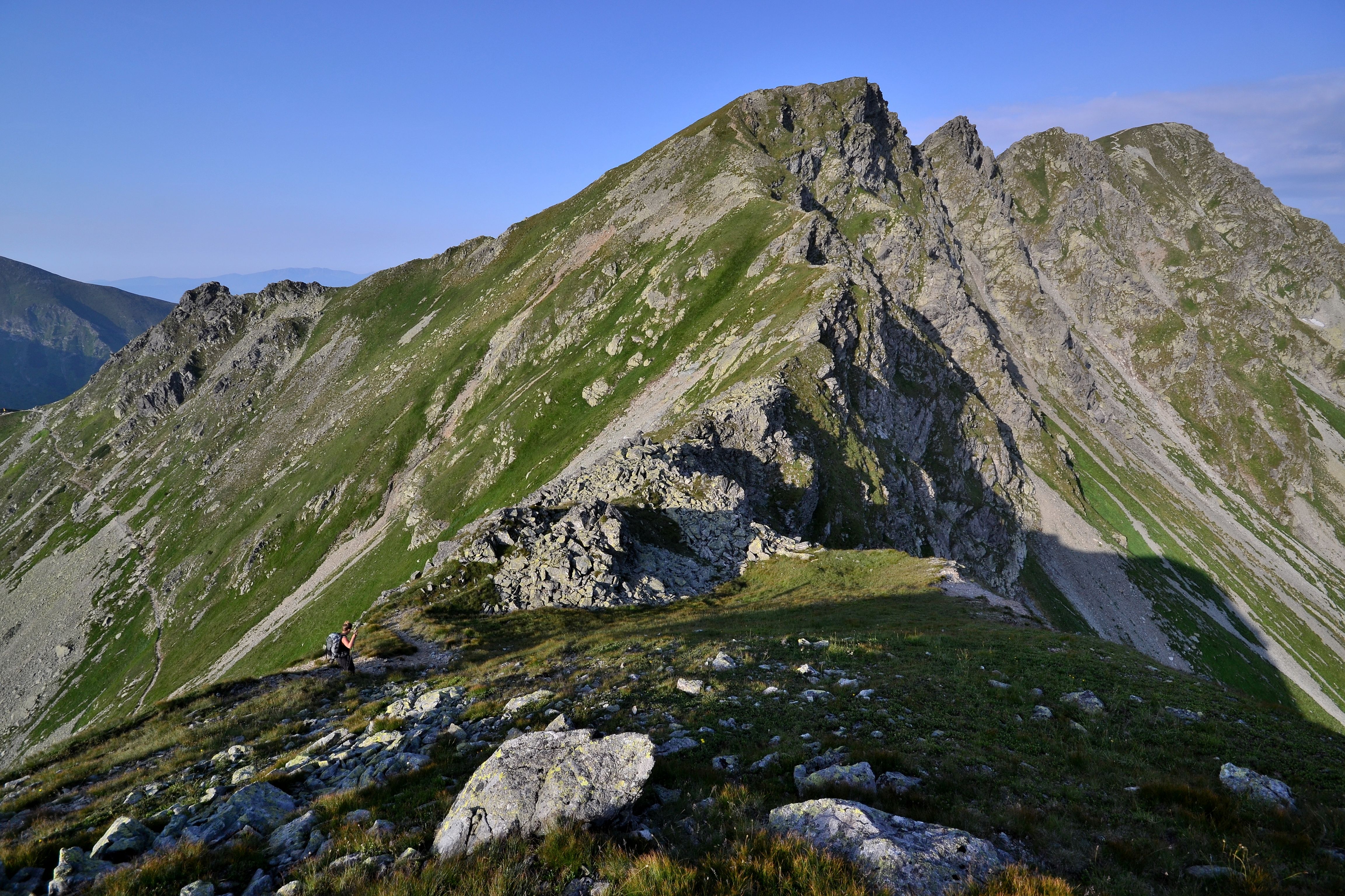
Veľmi náročná vysokohorská okružná túra vedie zo Spálenej cez Roháčsku dolinu a Smutné sedlo na hlavný hrebeň Západných Tatier. Hrebeňový prechod pokračuje cez Tri kopy (2 136 m n. m.) a skalnatú Hrubú kopu (2 166 m n. m.) až na Baníkov (2 178 m n. m.), najvyšší vrchol hlavného hrebeňa Roháčov. Trasa patrí medzi najťažšie túry v Roháčoch. Viaceré exponované skalné úseky sú zabezpečené reťazami a ich prechod vyžaduje skúsenosti s pohybom vo vysokohorskom teréne. Z Baníkova trasa zostupuje cez Baníkovské sedlo, Spálenú dolinu a okolo Roháčskeho vodopádu späť do Roháčskej doliny. Túru odporúčame absolvovať iba za stabilného a priaznivého počasia.
Turistika
Parametre trasy
Veľmi náročná
Dĺžka
16,2 km
Časový odhad
7 h 30 min
Prevýšenie
1 138 m
- Typ trasy Okružná
Turistická značka
Červená
Modrá
Zelená
Žltá
Začiatok
Pod Spálenou
Koniec
Pod Spálenou
Mapa trasy
Vybavenie a služby na trase
Platené parkovisko
Informačná tabuľa
Občerstvenie
Turistika
Parametre trasy
Veľmi náročná
Dĺžka
16,2 km
Časový odhad
7 h 30 min
Prevýšenie
1 138 m
- Typ trasy Okružná
Turistická značka
Červená
Modrá
Zelená
Žltá
Odkazy
Zaujal vás tento zážitok?
Stiahnite si aplikáciu Visit Orava a vyhľadajte ďalšie zážitky na Orave.